Aiman Tariq – Regional News Editor
Savannah, GA –
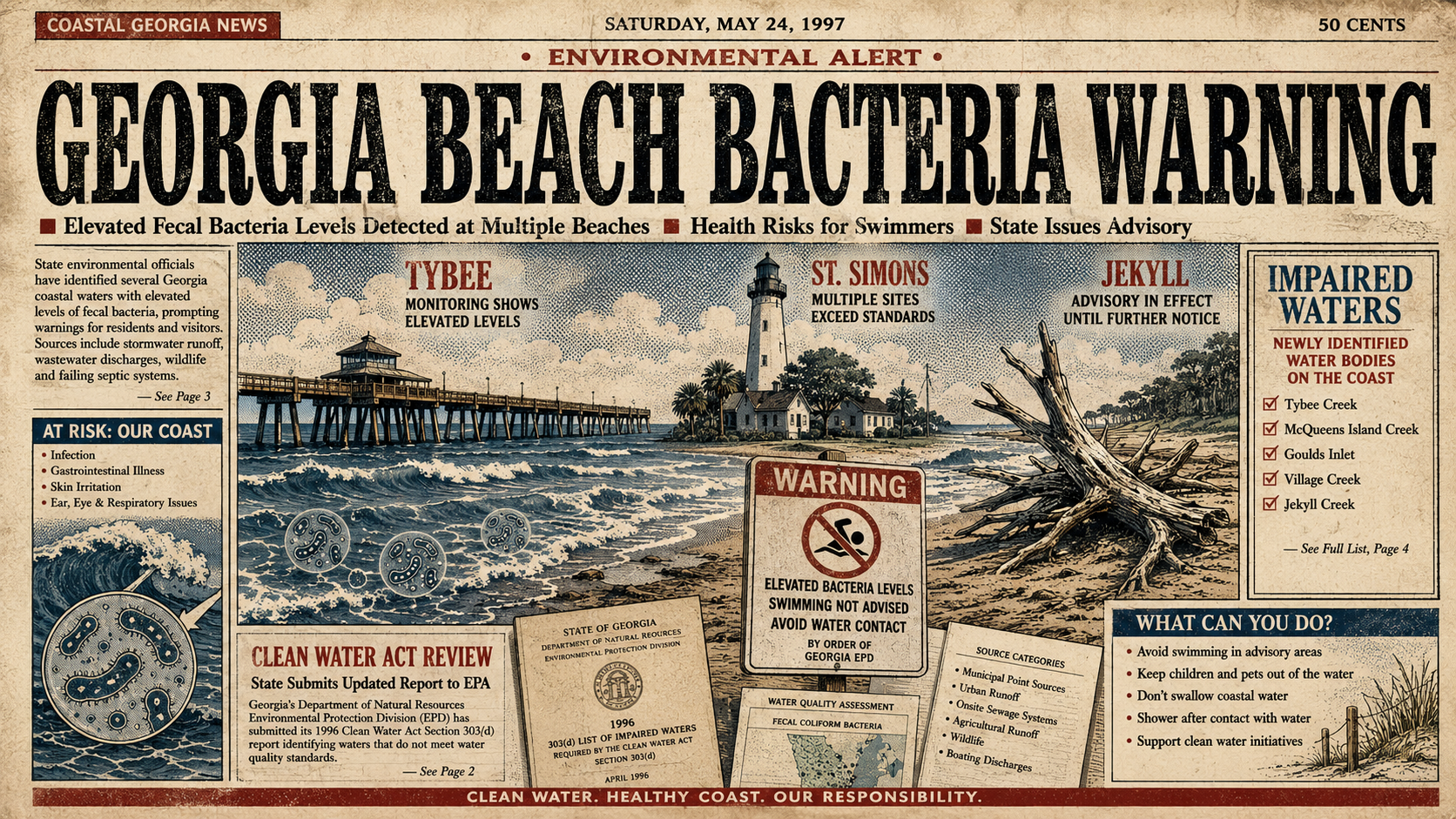
Georgia environmental officials have flagged stretches of beach on Tybee, St. Simons and Jekyll islands after bacteria levels exceeded recreation standards, adding roughly 15 miles of coastline to the state’s impaired waters list.
The issue is not that the entire Georgia coast has been closed. It is more specific than that — and also more complicated.
According to Georgia Public Broadcasting, the Georgia Environmental Protection Division identified beach segments where enterococci, a fecal indicator bacteria, were present at levels high enough to fail water quality standards. Those findings triggered a “Not Supporting” designation for recreation under the state’s water quality review process.
That does not necessarily mean every beachgoer who enters the water will get sick. It does mean state regulators found enough violations to require a formal cleanup-planning step under the Clean Water Act.
That distinction matters. Beach bacteria warnings often sound simple from a distance. In practice, they sit at the intersection of weather, wastewater systems, stormwater runoff, wildlife, tides, public health testing and how quickly agencies can identify where contamination is coming from.
What Georgia Flagged?
The impaired beach segments include parts of Tybee Island, St. Simons Island and Jekyll Island.
According to GPB, the affected areas include Polk Street Beach and Strand Beach at the Pier on Tybee Island, multiple beach segments on St. Simons Island, and portions of Jekyll Island including Driftwood Beach and North Beach at Dexter Lane.
The bacteria involved are enterococci. These bacteria are commonly used as an indicator in recreational water testing because they can signal the possible presence of fecal contamination.
That does not automatically identify the source. It only tells regulators that conditions failed the standard often enough to require closer attention.
Possible sources can include wastewater, septic systems, stormwater runoff, animal waste, boat discharge and other sources that move bacteria into beach water after rain, tide changes or drainage events.
The Georgia Environmental Protection Division has not yet identified the specific source of contamination in these beach segments.
Why “Impaired” Does Not Mean “Closed”
One point can get lost quickly: an impaired-waters listing is not the same thing as a temporary beach closure.
Georgia’s impaired waters list is part of a recurring Clean Water Act process. States must review water quality and identify waters that are not meeting their designated uses. In this case, the designated use is recreation.
A beach advisory, by contrast, is usually tied to more immediate sampling results. If bacteria levels are elevated in a current sample, local health officials may advise people not to swim or wade in a defined area until follow-up testing shows levels have dropped.
That is why readers should treat this listing as a warning sign, not a panic button.
It signals that certain beach segments have had enough bacteria violations to require a formal pollution-control plan. It does not mean every inch of those islands is unsafe every day.
The Clean Water Act Process
The Clean Water Act requires states to identify polluted surface waters every two years. Georgia does that through its water quality assessment process, comparing available data against state standards.
When a waterbody is listed as impaired, the state must eventually develop what is known as a Total Maximum Daily Load, or TMDL.
That phrase sounds technical because it is. In plain terms, a TMDL is a pollution budget. It sets a limit for how much of a pollutant a waterbody can receive and still meet water quality standards.
For the beaches listed in GPB’s report, Georgia is beginning that process for bacterial contamination.
Public comment on the proposed bacterial limits is open until July 16.
That comment period matters because it is one of the few points where residents, local governments, environmental groups, tourism businesses and property owners can weigh in before the state finalizes its approach.
Why Are Enterococci Used as a Warning Sign?
Enterococci are not the only bacteria that can exist in coastal water. They are used because their presence is a useful signal.
According to Georgia’s beach monitoring program, elevated bacteria levels can be associated with weather events, especially heavy rain and strong winds. Runoff after storms can carry contamination from streets, yards, septic systems, wildlife areas and other sources into nearby waterways and beaches.
That is why a beach can test poorly at one point and then return to acceptable levels after conditions change.
It is also why beach water quality is difficult to explain with one number.
A single sample can reflect recent rainfall, tide movement, drainage patterns, nearby infrastructure or wildlife activity. Repeated violations, however, give regulators a stronger reason to ask whether there is a recurring problem that needs a longer-term fix.
This is where the impaired-waters listing becomes more significant than a routine advisory.
It suggests regulators have seen enough data to say the issue is not just a one-off bad sample.
What Beachgoers Should Know?
For beachgoers, the practical guidance is fairly simple.
If a beach segment is under an active advisory, people should avoid swimming or wading in the affected area until the advisory is lifted. Fish and seafood caught nearby should be washed with fresh water and cooked thoroughly, according to standard coastal health guidance.
People with weakened immune systems, older adults and young children may face higher risk from exposure to contaminated recreational water.
The most common concern is gastrointestinal illness, though bacteria in polluted water can also contribute to skin, ear, eye or wound infections.
That does not mean every trip to the beach is risky. It means current advisory information matters.
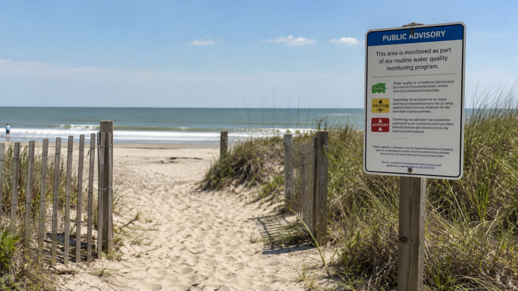
Georgia maintains beach advisory signs and posts current advisories through its coastal monitoring system. The Department of Natural Resources says there are advisory signs at popular access points on Tybee, St. Simons and Jekyll, and those signs are meant to reflect the most recent testing status.
Why Checking Before Swimming Matters
Beach water can look clean and still test poorly.
That is one of the frustrating parts of fecal indicator bacteria. The water may not smell unusual. It may not look cloudy. There may be no obvious sign at the shoreline.
That makes public testing and clear advisory systems important.
The responsible approach is not to assume a beach is unsafe every time a headline mentions bacteria. It is to check the current advisory status before swimming, especially after storms or during periods when local officials have already identified elevated levels.
That is particularly true on islands where tourism, fishing, recreation and local economies all depend on public confidence in coastal water.
Why Is the Source Question Hard?
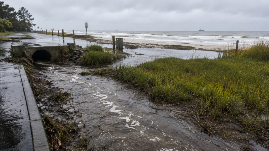
The state has not yet identified where the contamination is coming from.
That does not mean officials are ignoring the question. It means source-tracking in coastal areas can be difficult.
A beach bacteria problem can come from multiple sources at once. Stormwater can carry pet waste and wildlife waste. Septic systems can fail or leak. Wastewater infrastructure can be stressed by growth or storms. Boats and marinas can add another layer. Tidal movement can move contamination from one area to another.
That makes clean answers hard.
It also means the eventual TMDL process may have to account for several possible contributors rather than a single obvious source.
That matters for accountability. If the public is told only that “fecal bacteria” is present, the story sounds simple. But the policy question is more difficult: what system, land use, drainage pattern or infrastructure failure is responsible — and who is supposed to fix it?
Tourism and Public Confidence
Tybee, St. Simons and Jekyll are not obscure beaches. They are some of the best-known coastal destinations in Georgia.
That gives this listing a public-health dimension and an economic dimension.
Local businesses depend on visitors. Families plan summer trips around these islands. Residents rely on beaches for recreation, fishing and community identity.
That is why the wording matters.
A responsible story should not tell people the Georgia coast is unsafe. It should also not minimize repeated bacteria violations.
The more accurate version is that state regulators have identified specific beach segments that failed recreational water quality standards often enough to be formally listed as impaired. Now the state must move through the process of setting bacterial limits and determining how to reduce contamination.
That is less dramatic than a blanket warning. It is also more useful.
What Happens Next?
The state is now taking public comment on the proposed TMDLs for the affected beach segments.
After that process, regulators will have to finalize bacterial limits and continue working toward identifying and reducing sources of contamination.
For local governments, the issue may eventually connect to stormwater controls, wastewater infrastructure, septic oversight, runoff management or other source-reduction measures.
For beachgoers, the near-term step is more basic: check advisories before swimming, especially after heavy rain.
The Bottom Line
Georgia has flagged roughly 15 miles of beach on Tybee, St. Simons and Jekyll islands after enterococci bacteria levels failed recreation standards.
That does not mean every beach is closed or that every visit is unsafe.
It does mean the state has seen enough violations to list specific beach segments as impaired and begin the Clean Water Act process for setting bacterial limits.
The source of the contamination has not yet been identified.
That is the part to watch. The listing tells the public where the problem has shown up. The next question is where it is coming from — and whether state and local officials can reduce it before beach advisories become a more routine part of summer on the Georgia coast.